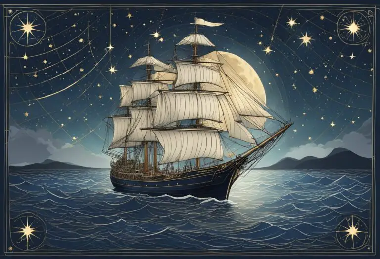
Celestial navigation is a bit like time travel, linking us to the ancient mariners who crossed vast oceans guided solely by the stars. I’ve always been intrigued by the simplicity and elegance of navigating by the heavens.
While GPS systems are the go-to in our modern world, there’s something deeply satisfying about plotting a course using the sky as it was done for millennia before satellites and electronics came into play.
I find that understanding the stars isn’t just for the professional sailor; it’s a skill that offers a deeper connection to the natural world for anyone who takes to the sea.
It doesn’t require complex mathematics or expensive equipment. With a basic understanding of star charts, a watch, and a sextant, you can unlock the celestial map that’s been used by navigators since ancient times.
Navigating by celestial bodies isn’t just a skill—it’s an art. It’s about feeling the rhythm of the earth and its cosmic partners, the sun, moon, and stars.
Each voyage becomes a personal voyage of discovery, a way to link to the past while charting my own path across the open waters. And honestly, there’s nothing quite like the thrill of successfully finding your way by using the same stars that have guided sailors for generations.
Celestial Sphere Basics
When I think of celestial navigation, understanding the Celestial Sphere is like grasping the universe’s map. It’s a hypothetical dome encompassing earth with stars painted on its inner surface.
Coordinates and Movement
The Celestial Sphere is my reference for pinpointing the location of stars and planets.
It uses a coordinate system similar to Earth’s latitude and longitude, but here latitude becomes declination, measuring degrees north or south of the celestial equator. Longitude turns into right ascension, expressing the east-west angle from the vernal equinox.
Movement across the sky is mainly due to Earth’s rotation. Stars seem to rise and set just like the Sun does, although they maintain the same declination and right ascension.
Star Identification
To identify stars, I first learn the major constellations which act as signposts.
Each star within those constellations has a proper name, like Betelgeuse in Orion, or a designation based on the constellation’s Latin name.
I use a star chart that shows stars’ positions at different times of the year for my location.
The chart helps me locate stars by matching their patterns in the sky with those on the chart, making sure I also pay attention to their brightness.
Navigators of the past connected stars into patterns and told stories about them.
Today, I find my way across the ocean by these same constellations, proving the timeless bond between sea explorers and the night sky.
Navigational Instruments
When I’m out on the open ocean, my trusty navigational instruments are pivotal. They’re like my celestial treasure map, guiding me through the stars.
Sextants and How They Work
The sextant is my go-to for celestial navigation; it’s fascinating in its simplicity and precision.
Here’s what I do with it:
I measure the angle between a celestial object like the Sun or a star and the horizon.
This instrument, which derives its name from the Latin word for ‘sixth,’ has two primary parts – the frame and the alidade.
The frame is shaped like a sector of a circle, and the alidade is used to sight the celestial object and read the angle from the graduated scale.
The key to using a sextant effectively lies in its mirrors – one half-silvered (the horizon glass) that allows me to see the celestial object superimposed over the horizon.
- Primary Components:
- Frame: A sextant’s body, shaped like a slice of pie.
- Alidade: The moving arm that I rotate to sight the celestial object.
- Mirrors: Where the magic happens, helping me line up the horizon and the celestial body.
Other Essential Tools
While a sextant is my star-sailing ally, there are other instruments in my celestial navigation toolkit.
A chronometer is critical—it tells me the exact time, which I need to calculate longitude.
Another must-have is a set of nautical almanacs and sight reduction tables; they’re like cheat sheets that help me decode what the sextant tells me.
Here’s what my toolkit usually contains:
- Chronometer: Keeps precise time to determine longitude.
- Nautical Almanac: Lists the daily positions of celestial bodies.
- Sight Reduction Tables: Helps translate sextant readings into location.
With these instruments, the algorithm is simple: I observe, record, and cross-check with my guides. Out here, where the ocean meets the sky, they’re my lifelines, ensuring I never feel lost, even in the vastness of the sea.
Practical Navigation Techniques

In the vastness of the ocean, I find that mastering a few specific celestial navigation techniques is essential for pinpointing my location. Let’s get into the practical bits that can help you find your way using the stars.
Sight Reduction
When I’m out at sea, “sight reduction” is my go-to process to translate what I see in the sky into a usable position on a chart.
Here’s the gist of how I do it:
- Take a celestial observation: Using a sextant, I measure the angle between a celestial body (like a star, planet, or the moon) and the horizon at a precise time.
- Note the exact time: I record the time of my observation with an accurate watch, because even a few seconds can make a difference.
- Consult the Nautical Almanac: I look up the celestial body’s position in this publication to find its coordinates at the time of my observation.
- Use sight reduction tables: With the measured angle and data from the Almanac, I use these tables to help me calculate my latitude and longitude.
This process entails plotting my observations on a nautical chart to cross-reference with data I have, breaking it down into steps that are easy to manage.
Fixing Position at Sea
After taking a few sights and reducing them, I use those sights to “fix” my exact position at sea.
Here’s what that involves:
- Plot lines of position (LOPs): For each celestial sight, I draw a line on the chart along which I know I must be located.
- Get a cross: When I have at least two LOPs from different celestial bodies, their intersection gives me a “fix” on my position.
It’s all about the intersection of these lines. Ideally, I aim for three to confirm the accuracy because the ocean can be a tricky place, and more data equals better precision.
Advanced Topics and Troubleshooting
In celestial navigation, mastering advanced techniques and solving issues as they arise ensures that I can always find my way, even when technology might let me down.
Handling Calculation Errors
When I’m working through the complex calculations required for celestial navigation, precision is key. A simple arithmetic mistake can lead to significant errors in fixing my position.
If the numbers don’t add up, I always double-check the following:
- Time: Is my watch synchronized? Timing errors can skew positional calculations.
- Arithmetic: Did I add, subtract, multiply, and divide correctly?
- Almanac data: Have I used the correct figures for the celestial body I’m observing?
Adapting to GPS Failures
If my GPS fails, it’s not the end of the world. I ensure I have a plan B by keeping up-to-date on my celestial navigation skills.
Here’s what I do to adapt:
- Fallback to traditional instruments: I make sure to carry a sextant, nautical almanac, and timepiece as standard equipment.
- Maintain a plot: I regularly plot my position using celestial sights to avoid being caught off guard.
- Knowledge refresh: I practice often, so the steps for taking sights and calculating positions stay fresh in my mind.